
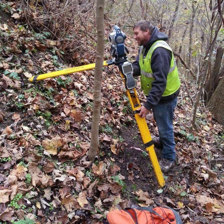
With the spark of the technological age shining brighter than ever before, advancements in tools and tech are saving tradesmen time, energy, and money. Land Surveyor Wes Sexton, for example, is taking advantage of the advancements in surveying and embracing a life with a new trick up his sleeve: surveying by drone.
Wes Sexton, 44, is a certified UAS pilot and Survey Crew Chief with W&A Engineering in Nashville, Tennessee. With over 30 years of experience working in the field, Sexton predicted that the land surveying industry would welcome advancing technology and volunteered to become a fully licensed drone pilot.
“A few years ago, I stepped back, looked at the industry, and figured that surveying would eventually go drone. I’m not always right, but I’m really glad that I was right about that,” Sexton laughed. “Drones are going to cut the time we spend in the field in half.”
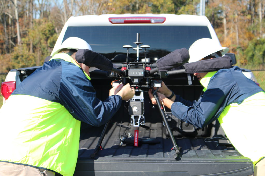
When the opportunity came around for select land surveyors at W&A Engineering to begin training with photogrammetry, the use of drone photography to gather precise measurements of terrain features, Sexton was quick to volunteer. Three years later, he regularly performs complex aerial surveys with only a compact drone and his iPad by his side.
“Photogrammetry is a piece of cake. Th drone can fly 100 acres in an hour,” Sexton adds. “That could have taken a ground crew over two weeks.”
The Drone Technology
Introducing drone flight into land surveying presents a whole new world of opportunities for land surveying and aerial photography.
Once a surveyor is presented with a site, the process is simple.
First, a flight plan is created to give the drone specific instructions on where to fly to capture every incline, every dip in the land, every tree, and every feature. Then, the pilot programs the plan into the drone using the iPad, travels to the project site, and sends the drone off to capture data and take photographs in a grid pattern, ensuring that the site is flown in its entirety.
“Once the drone is in the air, the work is pretty easy,” Sexton said. “You’re really just there to make sure nothing goes wrong.”
The drones used by the W&A team can fly for about 25 minutes before their batteries must be exchanged. In that time, it can fly approximately five acres, taking roughly 1,000 photographs.
After the drone has flown the entire site, the pilot returns to the office and begins processing the data. This includes extracting the photographs from the drone’s memory card and running them through software that stitches the hundreds of photographs together to create on mass photograph of the site.
The final product is a three-dimensional model created from the series of two-dimensional photos taken by the drone on site.
What would have previously taken a two-person survey crew weeks of time in the field to survey has taken one drone pilot and a compact aerial camera a few hours, saving both the client and service provider time and money.
Wes’s Story
Growing up with a father, uncle, and brother who are all registered land surveyors, Wes was more educated than most on the doors land surveying could open for a young person from a rural community. As young as 13 years old, Wes would accompany his father to local sites to assist in surveys, carry tools, and more.
Though he studied geology for a short time at a community college in Knoxville, Tennessee, he discovered quickly that college “just wasn’t [his] cup of tea,” transitioning instead to land surveying.
“I remember telling my dad, ‘I’m never going to survey for a living.’ Thirty years later, I’m still in the field,” Sexton said. “I went from making $3.75 an hour on my first jobs to making really good money now. It pays more than most jobs; I’ll tell you that.”
With decades of experience, Sexton is ready to step back and “make room for the younger guys.” He’s looking forward to mentoring young land surveyors, teaching new drone pilots, and learning more about the advancing technology in the field.
From new possibilities with laser scanning and constant improvements to the technology available, Sexton anticipates huge improvements in the industry and countless opportunities within the trade.
“I love land surveying,” Sexton said. “Anyone can do this. As long as you’re curious, willing to go the extra mile, and like being outdoors, you can be a surveyor and a drone pilot,” Sexton said.