LiDAR and Remote Scanning
W&A Engineering utilizes the latest drone surveying technology to provide 3D LiDAR scanning services throughout the Southeast. Access to laser scanning and modeling data can be invaluable assets throughout the planning, design, and execution phases of any construction project. Our expert staff provides precise data capture, analysis and documentation, and information delivery with custom deliverables services to enable our clients to successfully complete their most complex projects without the concern of unknown barriers and unexpected challenges.
Capable of capturing 500+ acres of survey-grade LiDAR data daily, our technicians deploy survey-grade laser scanners that are capable of collecting exact dimensions and measurements within 2-4 mm of accuracy. This laser technology allows us to deliver survey-grade data that is within 1 cm of precise accuracy. Our team has extensive experience working with licensed engineers and surveying professionals to provide custom deliverables with exactly the data they need delivered in detailed, yet easy to understand reports and deliverables. Our clients can expect industry-leading data capture, data processing, and data delivery made possible by our cutting-edge LiDAR and drone equipment, terrestrial laser scanners, and decades of industry experience.
- Surveying
- Planimetrics
- Vegetation Management
- Simultaneous Localization and Mapping (SLAM) and Terrestrial Scanning
- Photogrammetry
- 360° Virtual Walkthroughs
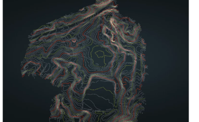
Surveying
Our technicians deploy survey-grade laser scanners that are capable of collecting exact dimensions and measurements within 2-4 mm of accuracy. This laser technology allows us to deliver survey-grade data that is within 1 cm of precise accuracy.
Deliverables: Digital Elevation Model (DEM) in TIF Format │ Contours (as precise as half-foot contours) │ Colorized Point Cloud │ Enhanced Classification of Ground, Buildings, Vegetation, Transmission Lines, and more │ Breaklines │ Custom Accuracy Report for Each Project │ Ground Classified LAZ file │ TIN Surface
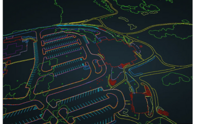
Planimetrics
Our planimetrics process combines superior artificial intelligence, machine learning, and quality control to create highly accurate planimetric deliverables.
Examples of standard planimetric layers:
Concrete Bottom, Concrete Top, Back of Curb, Top of Curb, Bottom of Curb, Foot Path, Paint Stripe, Paved Driveway, Paved Road, and many more.
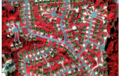
Vegetation Management
We understand that power-line corridor management is the key to delivering safe and uninterrupted electricity. With the help of industry-leading vegetation management software, we provide our clients with actionable intelligence from our LiDAR point cloud data. Our clients are able to visualize hazards within cloud-based software which enables quick viewing and cataloging of high-risk areas for each powerline corridor.
Deliverables: Classified LAS File of Features in Captured Area │ Classified LAZ File of Features in Captured Area │ Danger Points SHP File │ Map Display of Danger Points │ Obstruction Report
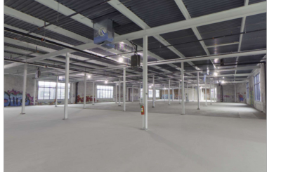
Simultaneous Localization and Mapping (SLAM) and Terrestrial Scanning
W&A Engineering uses a data capture technique called Simultaneous Localization and Mapping (SLAM) to allow for LiDAR data capture within GPS denied environments or areas where traditional aerial LiDAR data capture isn’t suitable, such as building interiors. W&A Engineering can create custom deliverables with our terrestrial laser scanners that can be used in architectural modeling, transportation design, municipal utilities, BIM modeling, consulting, and more.
Deliverables: Point Cloud Data in LAS or LAZ format │ 3D Terrestrial Laser Scans │ High Dynamic Range (HDR) Imagery │ Georeferenced Point Cloud │ As-Built Site Conditions │ Merged Aerial and Terrestrial Point Cloud
Photogrammetry
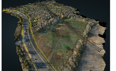
With the use of industry-leading software, the W&A team is able to provide our clients a wide range of deliverables from our highly-accurate photogrammetry data which is georeferenced with ground control points to orthomosaic data with which our clients can measure distances, area, volume, perform stockpile calculations, etc.
Our photogrammetry data also enables construction aerial progress monitoring. These progress reports help clients manage their projects without having to be physically located on-site. It also allows for current project conditions to be continuously updated depending on the needs of each project.
Deliverables: Colorized Point Cloud │Classified Point Cloud │ Digital Terrain Model (DTM) │ Digital Surface Model (DSM) │ Orthomosaic │ Contours │ Digital Elevation Model (DEM) │3D Models

360° Imaging
W&A Engineering also creates 360 virtual walkthroughs for our clients using 360 camera technology. This allows for capture of each step of the project to coordinate planning and visualize site progress. It also allows our clients to conduct visual inspections of their site while remaining out of harm’s way. The 360 data collected by W&A can be used alongside aerial orthomosaic maps for complete site documentation.
360 data increases safety and allows our clients to catch issues during projects rather than having to perform costly rework.
Deliverables: 360° Panoramic Images
